Biosis combine thermal video and ultrasonic calls with AI to monitor at-height microbat behaviour at windfarms in Australia
How is machine learning helping to monitor collision risk
Biosis is harnessing the combined power of thermal and acoustic monitoring with pattern recognition technology to shine a light on the invisible world of Australian microbats.
While the risk of wind turbines to birds is well understood and mitigation methods to manage this have gradually emerged, the impact on Australian bats is less clear. Wind turbines present a significant risk to bats, based on post-construction monitoring data from operational wind farms worldwide, and microbats are particularly vulnerable. Unfortunately, the cryptic behaviour of bats makes it difficult to design effective surveys to accurately predict turbine impact, which is possible for diurnal (daytime) birds.
As a leading ecology firm servicing the renewable industry, Biosis has set out to find an evidence-based and data-driven method to assist our clients to more accurately assess bat collision risk for their wind projects, and subsequently better inform site-specific mitigation strategies. Ultimately, we aim to minimise biodiversity impacts while maximising wind farm energy production, with data-driven and ecologically informed strategies.
Why is it Critical for Windfarms to better Understand the Behaviour of Microbats?
The Ecology Society of Australia notes that there is an urgent need for more research into the behaviour of Australian microbats moving through or living near a proposed windfarm site prior to construction. The problem of collision with bats and microbats is well documented in Europe and the United States, and curtailing turbine activity during high-risk periods of the night is now mandatory in some parts of the world.
How much of a risk wind turbines pose to bats at Australian sites has been hard to quantify, so advising proponents on collision risk, is something that ecologists have struggled with due to the absence of site- and species-specific data about local microbats. Given many microbats in Australia are already listed as threatened species, it is critical to find survey methods that can illuminate flight height level and species-specific behaviour at a local site level. This data will help ecologists’ advice curtailment timeframes or help inform design solutions prior to the construction of a windfarm.
The Problem with Only Using Ultrasonic Detectors to Determine Collision Risk
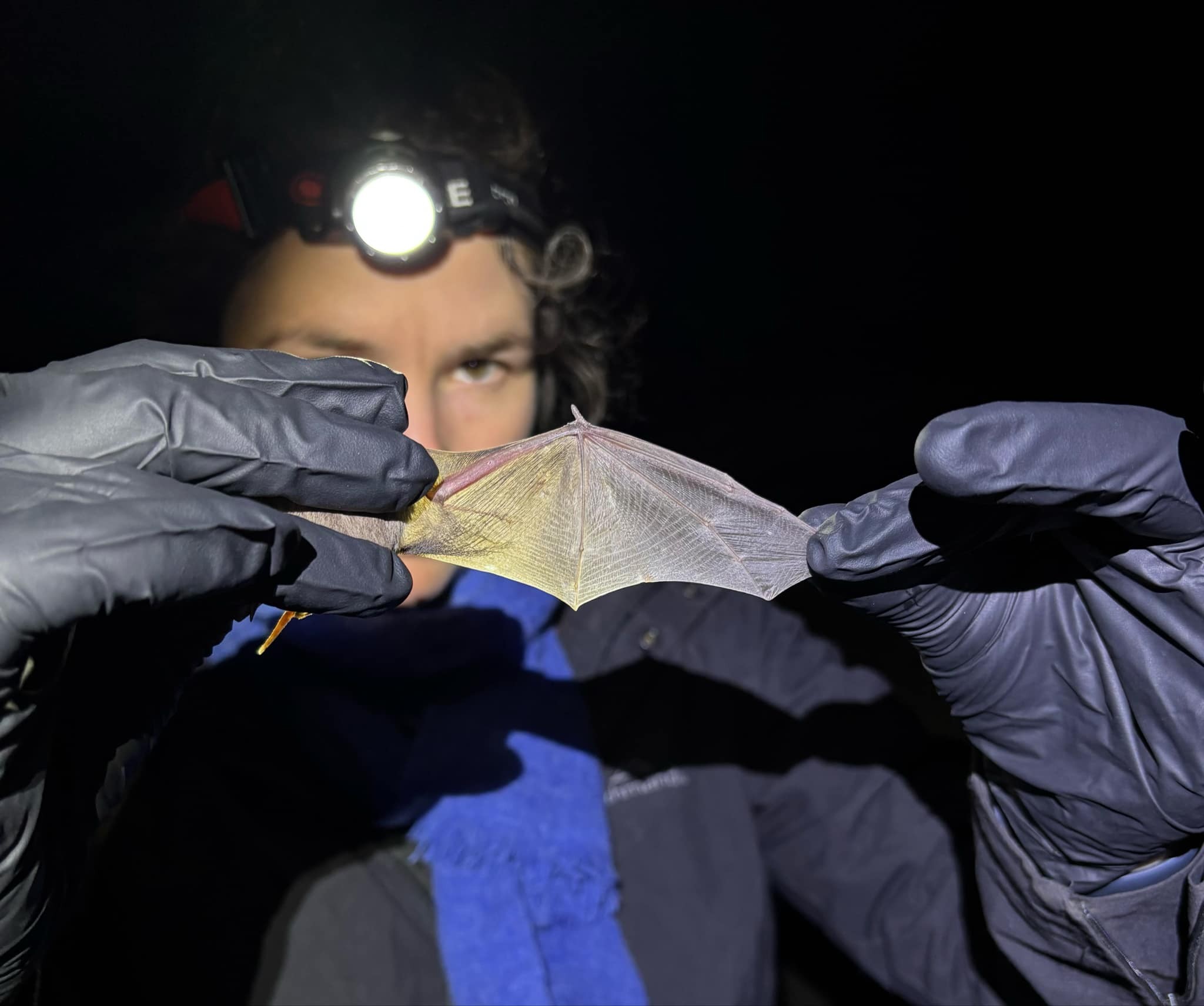
The current standard method for surveying bats relies on ultrasonic detectors of their echolocation calls; echolocation is high-pitched (ultrasonic) bat call that is recorded and then reviewed in a specialist program to identify calls to species. However, this data is limited in that it can often be difficult to identify all calls at a species level, it also does not allow for a count of individuals, and it does not allow us to visualise or map flight paths using this data. Quantifying impacts is therefore very difficult and often bat specialists rely on qualitative assessments of the potential risk of bat collision at a wind farm.
Machine Learning Expedites Object Tracking
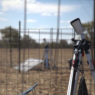
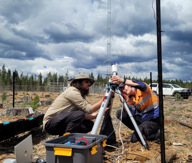
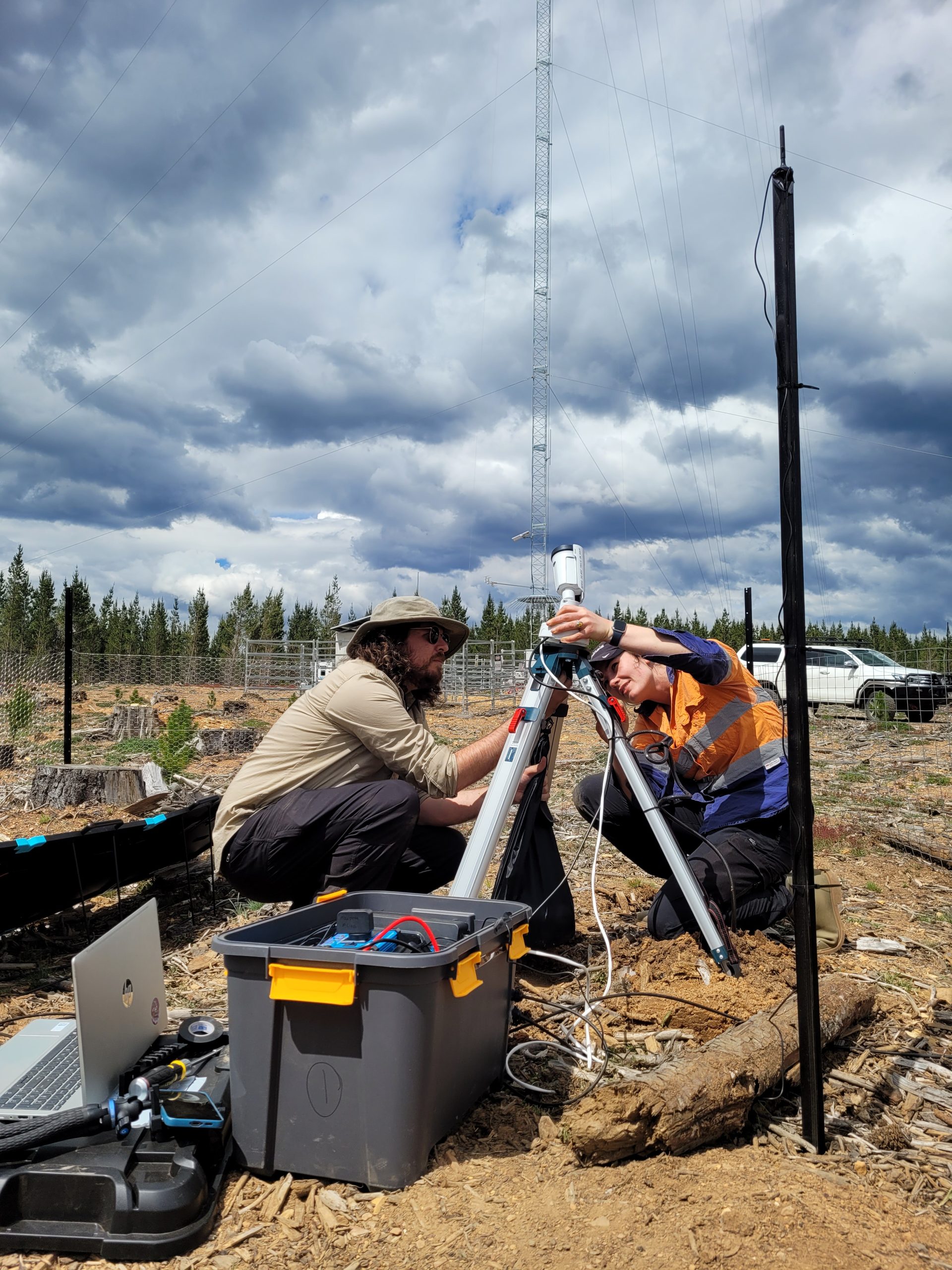
To remedy current survey limitations, Biosis Senior Zoologist (Bat Ecology) Felicity Williams has been working with international collaborators Wildlife Imaging Systems to employ stereo-thermal camera technology and machine learning algorithms, paired with sophisticated bat call recording technology, to visualise bat behaviour and flight height, offering a visible version of the night scene.
The Wildlife Imaging System software uses machine learning object identification algorithms to classify the differences between bats and other nocturnal species very efficiently, rapidly identifying bat tracks and recording flight height in 3D.


What the Data is Telling Us
Preliminary data analysis across four sites has already provided some fascinating insights into bat flight behaviour, and we are able to generate a site-specific flight height distribution profile for microbats between 0 and 120m, showing where many bat flights are recorded in vertical space, which is essential in understanding how close they’re flying to the proposed rotor swept area.
Our data shows that both call detection and thermal cameras provide complementary data for improving impact assessments, allowing us to both ‘see’ and ‘hear’ bats at the same time. Bat activity can be quantified into a metric of “bat seconds” that allows us to understand how long an individual bat is spending at a site so we can better estimate collision risk.
Learn more about our Bat Utilisation Surveys