The Biosis GIS Spatial Services team use Geographical Information System (GIS) technology and specialist expertise to deliver clear visual and location-based evidence supporting ecology, environmental planning and heritage reporting.
Biosis uses the Esri ArcGIS Enterprise platform to manage spatial data and create high quality maps for inclusion in our assessment reports and advice.
You can be confidant the Biosis GIS Spatial Services team are reviewing the most up to date authoritative datasets available in Australia.
- BioNet Atlas of NSW Wildlife records
- NSW State Vegetation Type Map
- Key Fish Habitat maps
- Interim Biogeographic Regionalisation for Australia (IBRA)
- NSW National Parks and Wildlife Service (NPWS) Estate
- Biodiversity Values (BV) Map
- NSW Foundation Spatial Data Framework (FSDF) datasets
- Aboriginal Heritage Information Management System (AHIMS)
- State Heritage Register (SHR) Curtilages
- Soil Landscapes of Central and Eastern NSW
- NSW Seamless Geology
- Acid Sulfate Soils Risk
- Environmental Planning Instrument (EPI)
- Nearmap, Spatial Services NSW Imagery and Vicmap Aerial Imagery
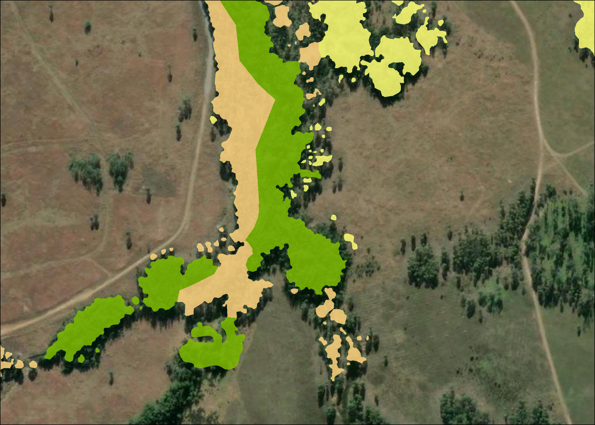
The GIS team support both internal and external clients to compare and visualise available datasets and use their expertise to help solve complex planning challenges and contribute to sustainable development objectives. Large-scale infrastructure planning, or significant environmental modelling, is best served by analysing biodiversity or heritage values and topographical features and comparing those features with other data sets like waterways and the proposed project footprint. Robust analysis of available visual data sets can help ensure your project is planned effectively.
Yes, the Biosis GIS Spatial Services team can support external ecology consultants in NSW and Victoria to deliver their map reporting deliverables.
Can Biosis Supply Heritage Mapping Services for External Consultants?
Yes, the Biosis GIS Spatial Services team can support external cultural and historical heritage consultants in NSW and Victoria to deliver their map reporting deliverables.
The Biosis GIS Spatial Services team ensure clients are kept up to date with any Biosis consultant work underway through an accessible online web app. The application allows clients to view curated maps with features relevant to their project using their own device, making it easy for them to keep a track of any ecology or heritage surveys or desk-top assessments underway.
This is particularly helpful for clients who are managing multi-year monitoring projects and must report updates on their project quickly to internal teams and to help inform decision-making.
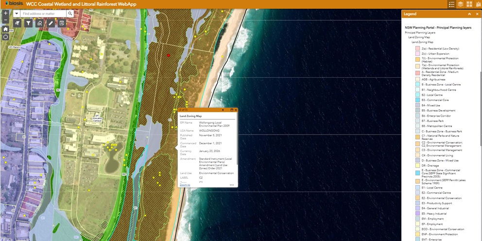
Custom web mapping apps can provide online access to field data collected by Biosis consultants, and relevant authoritative data sets available from other providers such as state and commonwealth government agencies. If your organisational data (e.g. project design) is supplied in a compatible format, then we can also embed that layer into the project’s unique web application.
How Soon can I Access an App to see the Progress of my Biosis Project?
Simple web mapping apps can be set up and ready to go with just a few hours of effort.
Why are Accurate Maps an Essential Reporting Tool?
Maps are a required reporting tool for mandatory environmental and heritage impact assessment reports to convey complex information in a concise and visually appealing way. Accurate maps convey scale, important features, and spatial relationships between features without needing lengthy and convoluted written explanations.
Key Team Members

Sally Mitchell
Team Leader – GIS (Victoria)
Lauren Harley
Team Leader – GIS (NSW)