Present your ecology or heritage assessment project work to community and stakeholder groups using Biosis’ ArcGIS Storymap technology.
ArcGIS StoryMaps are web pages that merge text, images, video, audio and interactive maps into an engaging and accessible experience to communicate information about your project to a broad audience.
StoryMaps guide the user through a topic in an online article or blog, but with the ability to embed interactive maps and visual evidence throughout.
What is ArcGIS StoryMap Functionality Good For?
StoryMaps are an excellent way to present your ecology or heritage assessment project work to community and stakeholder groups.
Dense, complex documents can be converted to a guided and engaging experience that clearly conveys critical information about the project.
The flow of the information can be presented in a simple, scrollable webpage, punctuated with images of your project.
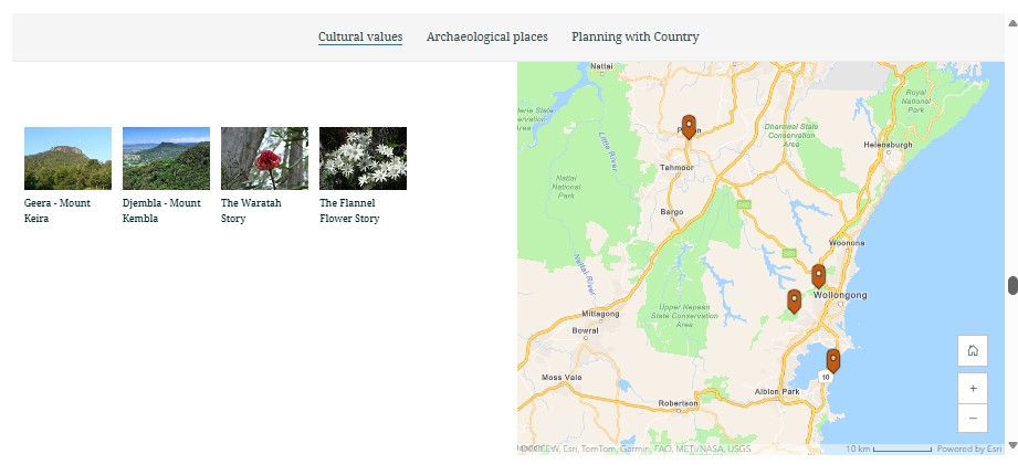
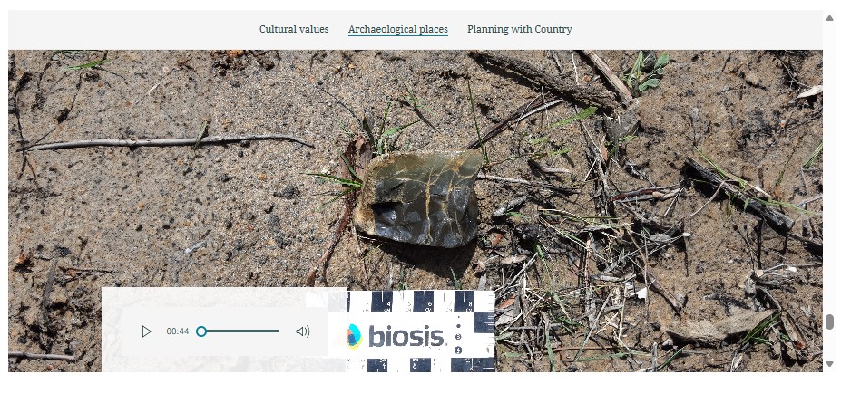
You can even add video, audio or interactive maps, with pop-ups configured to highlight key features and display additional information about location-specific project elements.
- The progress of infrastructure projects.
- Results of an EIS.
- Cultural or historical heritage research or shared knowledge. (such as the “Yanmanjang – Walking Together” Story Map created by Biosis, embedded below)
- Digital Environmental Impact Statements (Digital EIS).
What’s involved?
Creating a StoryMap can be a relatively quick process once the underlying content has been created. The Biosis GIS team upload any mapping data to our secure GIS server along with any other media used in the StoryMap.
The StoryMap Designer App hosted on our GIS Portal is used to create a draft story map. This draft layout is shared with the client using a secure login to allow collaboration on the final design, before being shared publicly.
Stakeholders are able to access the StoryMap information via a website URL or you can embed the StoryMap in your own website.
As part of planning for the Picton Road upgrade, Transport NSW worked with Dharawal Knowledge Holders, Registered Aboriginal Parties (RAPs), Traditional Owners and other Aboriginal stakeholders to understand potential impacts to Aboriginal heritage and cultural values. The results of the ecological assessments and cultural heritage research were produced into a StoryMap by the The Biosis GIS Team and shared with local communities. This link can be shared with community groups and made available on any website to be viewed on their own device. View this
If Biosis are already undertaking ecology and/or heritage works on your project, we can create a StoryMap to communicate the process and findings to the wider community if that is a requirement of your project. Our expert ecologists and archaeologists work closely with our GIS team, with guidance from experienced copywriters and science communicators in our Business Development team, to publicise the good work being done to engage with and protect cultural, and biodiversity values associated with your project.
Key Team Members

Lauren Harley
Team Leader – GIS (NSW)
James Shepherd
Technical Director