Cumberland Plain Conservation Plan
- Client: NSW Department of Planning, Housing and Infrastructure
- Year: 2017 – current
- Project: Cumberland Plain Conservation Plan (GIS spatial services)
Background
The Cumberland Plain Conservation Plan (CPCP) is a strategic biodiversity assessment of a large area of Western Sydney in growth areas surrounding the new Western Sydney Airport. The ambitious project aimed to create a plan for four of Sydney’s growth areas and add relevant large-scale data that balances both development and conservation needs. Biosis has provided ecological advice, GIS modelling and a mapping application, and impact calculations throughout the development of the CPCP since 2017, and Biosis continues to provide spatial server support to the Department.
GIS Outcomes
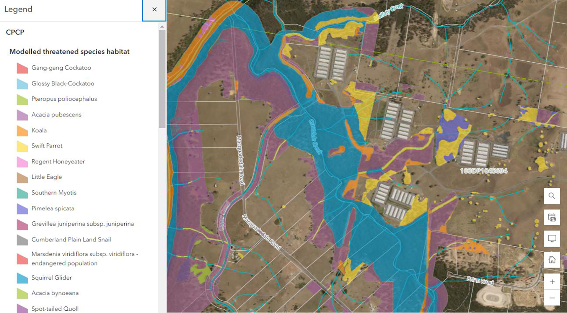
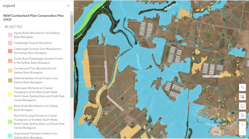
The Biosis GIS team has been providing the client with agile mapping and spatial analysis support allowing them to meet tight deadlines and provide accurate advice within the department and to the Minister’s office. By using innovative spatial modeling techniques, Biosis was able to provide wide scale mapping of potential threatened species habitat over an area that would have been impossible to cover on-ground within the provided time frames. By giving key stakeholders access to current, detailed mapping through the web mapping app, Biosis facilitated efficient communication of critical issues across the teams. The CPCP was approved by the NSW state government in 2022 and Biosis has been working with Open Lines to further modify the plan following public exhibition.
Services Provided
- Assistance with digitisation and spatial calculations of proposed land categories.
- Development and provision of a web mapping application for client and stakeholders to visualise and explore key spatial datasets.
- Creation of complex habitat models through distilling expert knowledge into spatial parameters applied to multiple input datasets.
- Complex impact calculations.
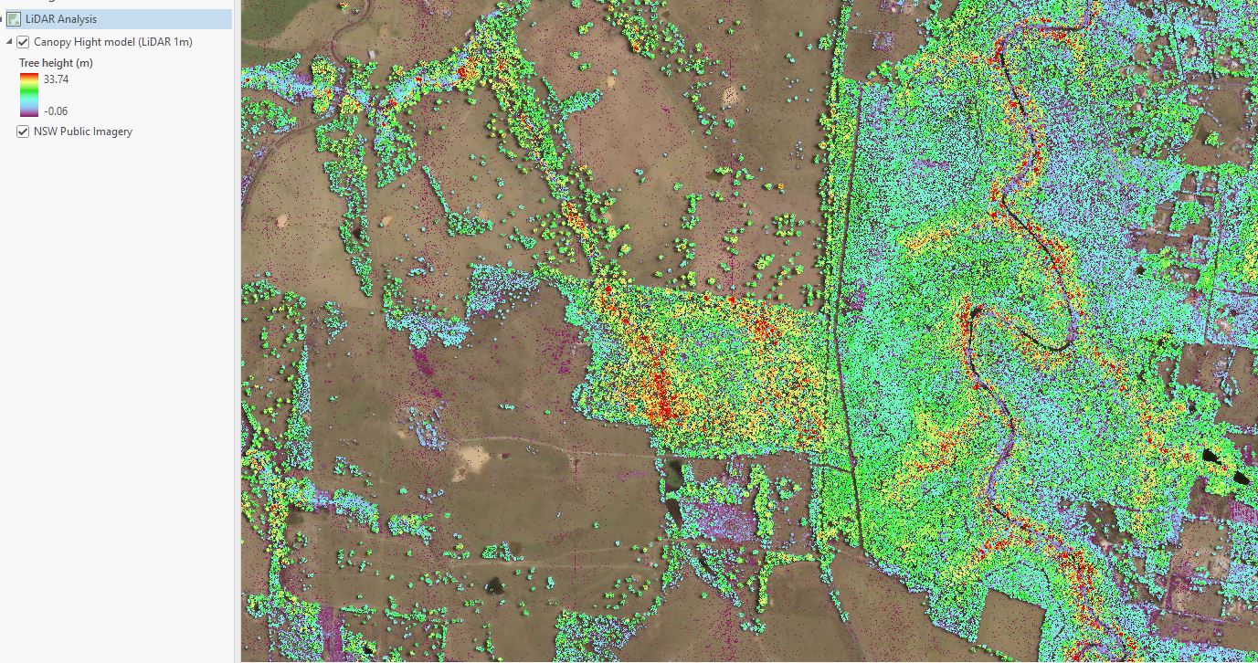
- Detailed desktop mapping of vegetation communities using LiDAR analysis, classification of multispectral imagery and aerial photo interpretation.
- Production of high quality interactive PDF maps for the CPCP Biodiversity Certification Assessment Report (BCAR).