An Archaeology Map, Spatial Risk Decision Support Tool
Client: VicTrack
Location: Victoria
Date: ongoing
Services provided
- Development of an Aboriginal archaeological predictive model covering all of VicTrack’s land holdings.
- Study area georeferencing thousands of digitised biodiversity and heritage consultant reports commissioned by VicTrack.
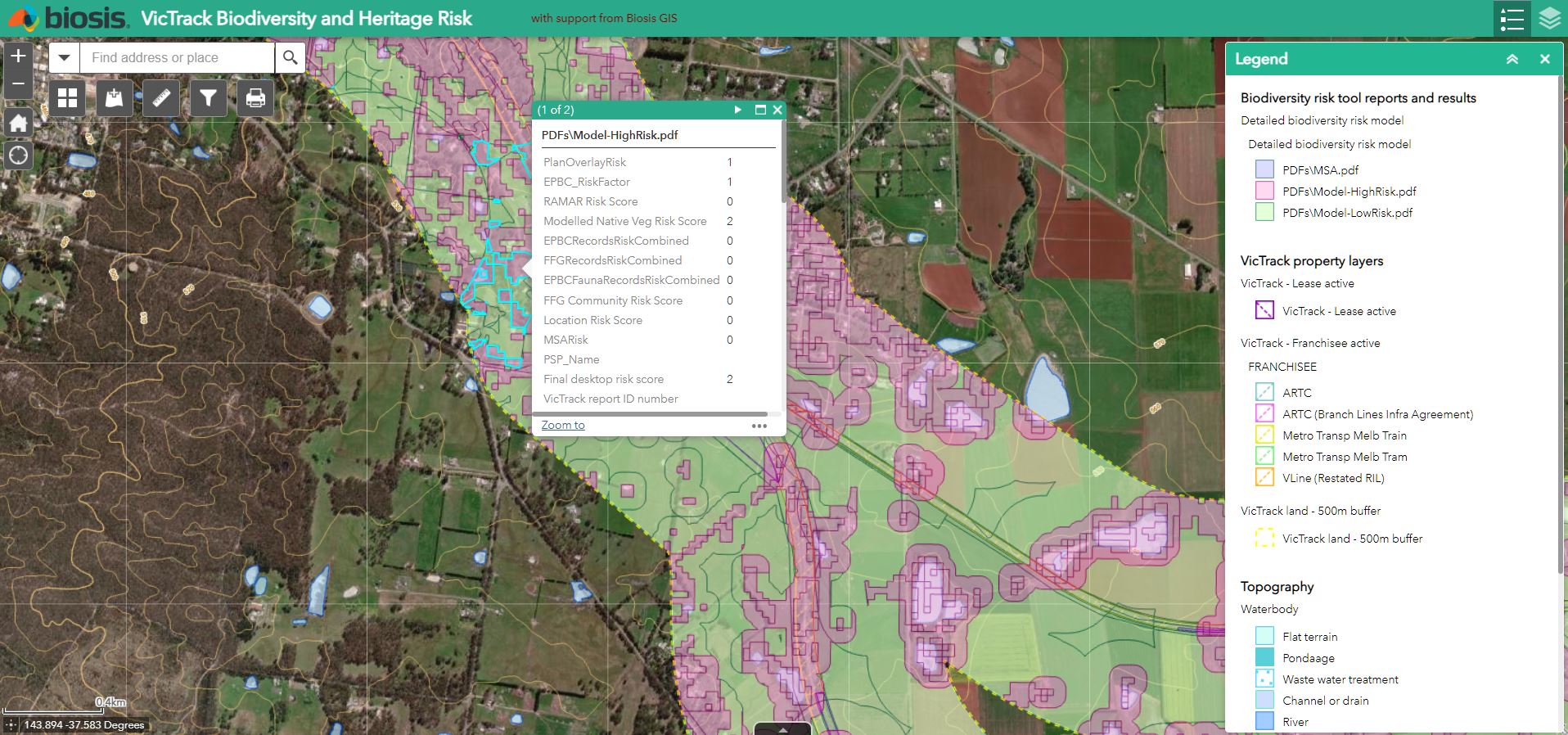
- Summary of each report’s outcomes attached to a spatial data table.
- Development of complex decision models to determine legislative obligations across all of VicTrack’s land holdings based on predictive modelling, cultural values mapping and report outcomes.
- Creation of decision flowcharts and advice documents linked to the risk categorisation of a location to guide VicTrack staff through the approvals process.
- Annual additions of new consultant reports and model outputs.
Background
VicTrack administers and maintains thousands of kilometres of railways and associated infrastructure across Victoria.
In 2013 Biosis proposed and subsequently developed the Spatial Risk Decision Support Tool. This tool uses a combination of spatial modelling, summaries of reports held by VicTrack, and decision flowcharts developed by Biosis to give VicTrack staff a quick and simple overview of the potential biodiversity and heritage issues across each lot of their landholdings.
Biosis updates the underlying models and report summaries annually for the tool.
Outcome
VicTrack ecology and heritage staff have access to a stand-alone platform to query any location for potential biodiversity and heritage risks, significantly increasing the efficiency and accuracy in determining next steps for development and maintenance works.
This has been developed by Biosis and VicTrack, and Biosis provides ongoing support and updates for this tool.