Biosis’ in-house GIS spatial services team collaborate with our ecologists to develop robust predictive habitat models that identify and map areas where Australian threatened species are likely to occur, providing valuable insights to support informed environmental and land-use decision-making.
You can contact Biosis consultants at any one of our local offices in Sydney, Melbourne, Newcastle, Geelong, Wollongong, Central Coast, Bendigo, Ballarat, Wangaratta, Penrith or Hobart.
Threatened species habitat is often a significant constraint on development and can be difficult to accurately identify without extensive, targeted surveys undertaken at appropriate times of the year (often spring, depending on the species). Even with survey effort, it can be difficult to rule out areas that might be essential habitat.
To provide additional understanding of a location’s potential to be important habitat for a threatened species, Biosis create spatially located, knowledge-based models that combine insights from our ecology team with spatial analysis expertise from our GIS team.
Sample Habitat Model.
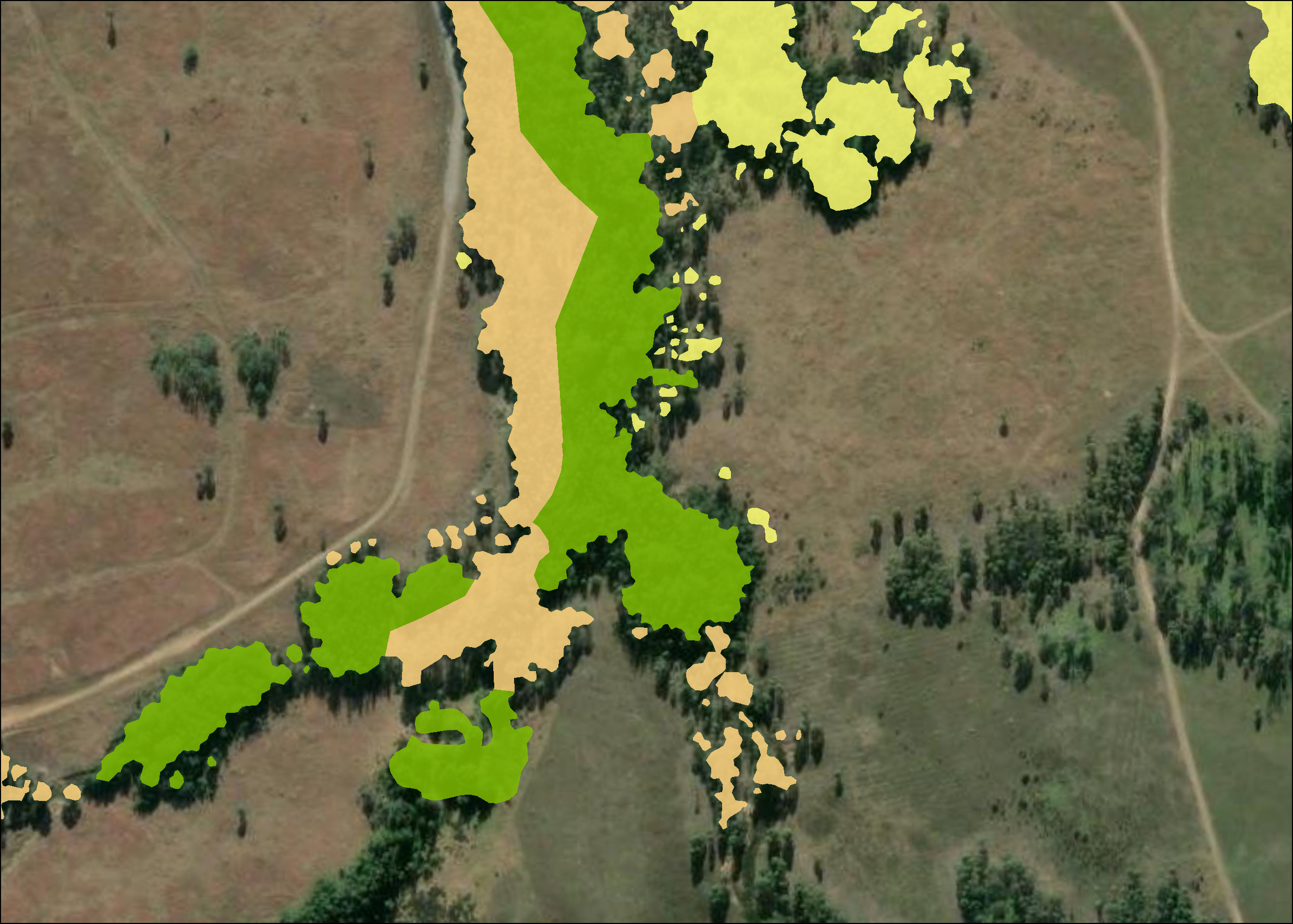
Biosis GIS specialists, in collaboration with Biosis ecologists, combine multiple data layers such as vegetation type, terrain models, tree density, canopy height models, soils, geology, prior identification records and survey data to determine the likelihood of habitat existence. This modelling is produced on a site-by-site basis.
Each model is created for a single species, tailored to the project location to ensure the most accurate result with the available data. The input layers are filtered, weighted according to which features are most suitable for the species’ habitat requirements, and then combined with the other layers to give an overall value of habitat significance and/or likelihood.
Simple or Complex
Models can be relatively simple, requiring only a small number of layers and parameters, or significantly more complex, relying on highly detailed and processed datasets such as canopy height and hydrological models created from LiDAR data.
The final output of the model is presented as a vector polygon layer that preserves information about the specific features driving habitat existence at any given location.
Key Team Members

James Shepherd
Technical Director
Lauren Harley
Team Leader – GIS (NSW)