Biosis gives ‘Sweet for ArcGIS’ a thumbs up!
Biosis field staff have been testing a new data collection application and concluded they can capture and edit the vegetation data more accurately as they survey.
When Biosis ecologists are tasked with mapping vegetation or completing habitat surveys in NSW or Victoria for environmental impact assessments, the most efficient way to record their investigation is usually on ArcGIS Field Maps using a tablet, capturing the data in real time on industry standard software. But like a lot of industry standard software the user experience could sometimes be, well, sweeter.
Our consulting ecologists survey areas in the field and quickly record vegetation zones and habitat features such as plant communities, stick nests or hollow bearing trees, ultimately gathering data within a target area and recording it virtually on a digital map with defined regions (polygons).
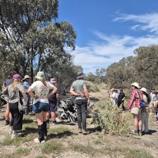
Biosis ecologist on a typical survey
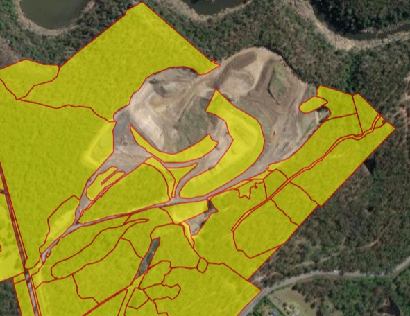
Messy Boundary Lines
The problem is, while Field Maps is excellent at capturing the data, boundary areas can get messy when you’re surveying for features within the same layer, such as vegetation communities. The survey may result in several overlapping polygons which don’t correctly show the transition boundaries between different features and don’t accurately represent the area of extent of a feature, such as a vegetation community.
At complex sites, where there’s more hilly terrain and gullies, the vegetation zones and habitats will be naturally more diverse, often resulting in even more squiggly polygon boundaries for the ecologist or GIS team to clean up back at the office. Our clients require reports that are easy to understand with clearly illustrated mapping.
Capture and edit correctly in the field
Cleaning up field data after the original survey, via office-based GIS support staff, is often a time-consuming and costly process, our GIS support team can spend additional hours cleaning up field survey data, and depending on the size of the capture area it can be considerable. But not anymore!
A collective smile is spreading across the faces of Biosis ecologists as they road test a new ArcGIS-based field collection application called ‘Sweet for ArcGIS’. “Sweet” the word no doubt muttered as they use the tool to tighten their vegetation mapping while out in the field (rain, hail or shine).
Developed by Esri UK, it’s a relatively simple efficiency tool that cleans up polygon boundaries and is directly integrated into ArcGIS software. Ecologists can snap over-lapping boundaries together as they walk, removing gaps immediately, forming a single line where multiple polygons coincide. No more squiggles and overlaps.
They can edit existing polygons using cut, reshape and merge tools. Field staff have been testing Sweet now for 6 months and have concluded the editing tools make capturing detailed features with the freehand method faster and more efficient. They can get it right the first time while still in the field.
With field applications constantly evolving, specific niche use cases like ours can often fall through the cracks as technology develops. Fortunately, when we engaged Onneer in January 2025, they could showcase Sweet for ArcGIS’s robust system and helped us implement the powerful tool. It successfully filled the gaps so Biosis could complete critical field work.
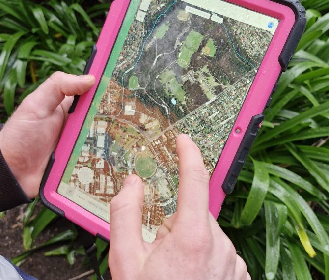
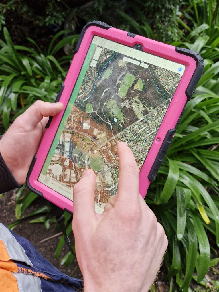
With overlapping polygons
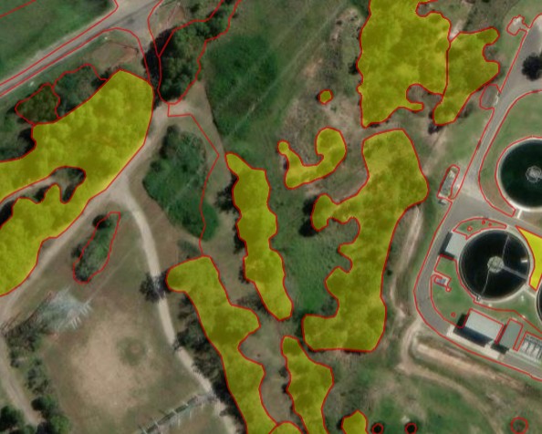
Sample image of a vegetation survey using ARCGIS for Sweet application
Deployment
The deployment was well planned, efficient and relatively trouble free. The Onneer team are local suppliers of Sweet for ARCGIS and have been a pleasure to work with throughout the deployment and continue to support our team.
While we’ll still use Field Maps as our primary field data capture app, Sweet will provide that critical functionality to make our polygon capture workflows vastly more efficient and enjoyable. It’s also saving GIS support staff time with fewer misunderstandings between field staff and reporting edits.
Overall, it’s a sweet deal for everyone.